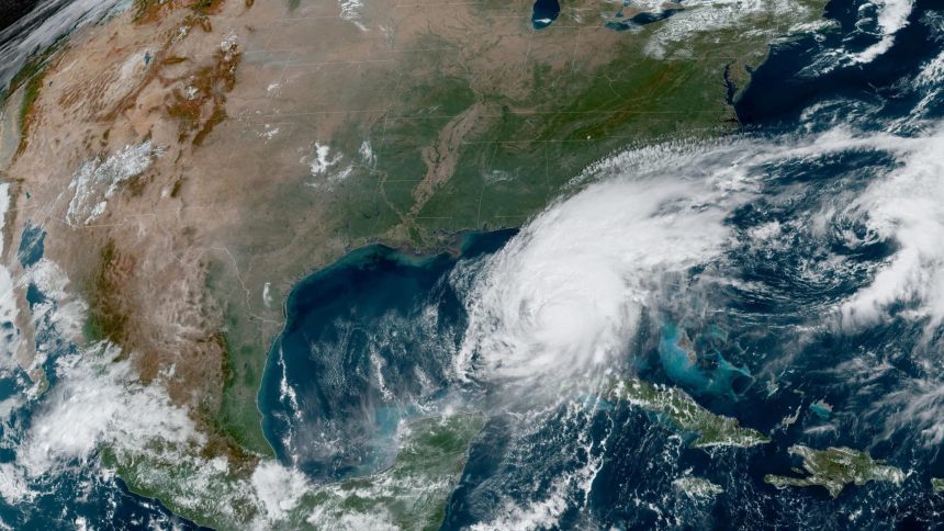
Steady rain hit the Tampa area Wednesday morning and winds are expected to increase in the afternoon as Floridians rush to prepare for Hurricane Milton. The storm continues to fluctuate in intensity as it approaches the state’s west coast and is expected to make landfall as a Category 4 hurricane, the second-highest rating.
The National Hurricane Center said on Monday that the storm had intensified into a Category 5 storm, but dropped down to a Category 4 Wednesday morning with sustained winds of up to 155 mph. The NHC said that the storm will remain a hurricane as it crosses the Florida peninsula.
A storm surge warning is in effect for the central to southern west coast of Florida, including Tampa. The NHC warning indicates “a danger of life-threatening inundation, from rising water moving inland from the coastline, during the next 36 hours in the indicated locations.”
As of 11 a.m. on Wednesday, the storm was about 190 miles southwest of the Tampa metropolitan area and moving northeast at about 17 mph with sustained winds of 145 mph. The hurricane will likely make landfall late Wednesday night or early Thursday morning, according to the NHC.
Milton rapidly intensified as it crossed the Gulf of Mexico from the heat of the gulf’s surface waters. When a storm forms into a hurricane it absorbs energy from the heat in surface waters and, with 2024 on track to have the warmest average global air temperature on record, it is no surprise that Milton was able to grow stronger in such a short amount of time.
Close to 6 million people in more than 10 counties are under evacuation orders. The Federal Emergency Management Agency wrote on Wednesday that “Your life is at serious risk if you don’t take action immediately – every second counts.”
Florida Governor Ron DeSantis said people near the coast still have time to evacuate inland and recommended they head to one of the 149 general population shelters open throughout the state.
“The current total shelter population is just 31,000 individuals. We have room in those shelters for a total population of almost 200,000 individuals. So there is space available in these shelters,” DeSantis said in a storm briefing Wednesday morning. He said he expects more people to head towards shelters Wednesday afternoon and night.
DeSantis also said the Florida Highway Patrol has facilitated 106 long-distance fuel tanker escorts to transport close to one million gallons of gasoline into Tampa and other areas.
Gas stations around the state have already run out of fuel as people attempt to either leave the state or have fuel on stock for at-home generators. Around 23%of the state’s 7,900 gas stations are currently without fuel, up from around 17% on Tuesday, according to data from GasBuddy.
FEMA administrator Deanne Criswell recommended on Wednesday that Floridians in areas under storm surge watch should still try to evacuate, even if only a few miles inland. “Milton is going to be a deadly and catastrophic storm,” Criswell said in a press briefing.
Criswell also said she will be traveling to Florida on Wednesday to help with recovery efforts once the storm hits. “I want people to hear from me directly, FEMA is ready,” she said.
The National Weather Service issued a tornado warning on Wednesday for most of central and southern Florida, including Miami-Dade County. The warning also includes hail up to a half inch in size and isolated gusts of up to 70 mph.
At 11 a.m., the NHS reported tornadic supercells across southern Florida. The NWS already reported a tornado along I-75 near Miami as outer bands of the hurricane moved through the area.
Another tornado was recorded near the Everglades, wetlands on the southern tip of the Florida peninsula.
The rushed preparations for Milton come as Floridians are still recovering from Hurricane Helene, which made landfall on Sept. 26. More than 225 people died from the storm and recovery efforts lagged as the storm isolated communities. Helene also highlighted the unpredictability of hurricanes, as the storm transitioned into a tropical storm and still ravaged the inland city of Asheville, North Carolina.
Read the full article here


